Geography
Geography
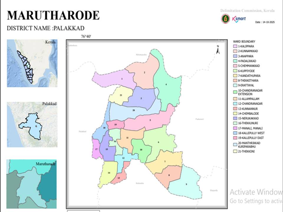
Physical features and boundaries of Marutharoad Grama Panchayat
Geographical LocationMarutharoad is a Grama Panchayat situated in Palakkad Taluk under Malampuzha Block in Palakkad District. The region features a mixed topography comprising plains, agricultural lands, and wasteland. Following the 2025 ward delimitation, the total number of wards in the Panchayat has increased to 21. |
Boundaries
| Soil & TopographyThe area mainly consists of laterite soil and alluvial soil. The region is characterized by highly fertile soil suitable for paddy cultivation and various vegetable farming. |
Water ResourcesStreams, canals, check dams, and ponds flowing through the Panchayat are the main water sources. Canal water from the Malampuzha Dam is utilized for agriculture. | ClimateDue to the presence of the Palakkad Gap, a tropical climate with relatively high temperatures is experienced here. Good rainfall is received during both the South-West and North-East Monsoons. |
Palakkad Taluk | Malampuzha Block Panchayat | Plains / Agricultural Topography |
WARD MAP Link : https://wardmap.ksmart.live/map?district=Palakkad&type=Grama%20Panchayat&localbody=Marutharode